
There’s more than one way to choose your own adventure and get the trails’ eye view of Winnipeg. Check out all these cool maps!
Detailed Winnipeg Trail Maps
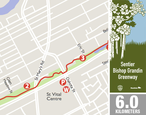
Over 30 detailed trail maps have been created in a joint effort by the Winnipeg Trails Association and the Prairie Pathfinders. Each map is a two page overview that can be viewed online or printed on a home printer on letter sized paper. These maps offer a unique detailed insight to each trail highlighting:
- surface type
- trail length
- refreshments / washroom facilities / parking
- connecting trails
- exceptional points of interest found along the trail with short descriptions
Winnipeg Trail Map Information Pages
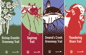
- (The trail formerly known as) Bishop Grandin Trail East
- (The trail formerly known as) Bishop Grandin Trail West
- Bois-des-Esprit
- Bridgewater Forest Trails
- Brooks Trail
- Bunn’s Creek Trail
- Sentier Cloutier Trail
- Cornish Path
- Cordite Trail
- Dakota / Dunkirk Pathway
- Gabrielle Roy Route
- Harte Trail
- Headingley Grand Trunk Trail
- Henteleff Park
- Kildonan Park Golf Course
- Little Mountain Trail
- Louis Riel Sr. Route
- McGillivray Trail
- Niakwa Trail
- Normand Park Trail
- Northeast Pioneers Greenway
- Omand’s Creek Greenway Trail
- Old St. Boniface Route
- Pandora Pathway
- Preston Trail
- Sagimay Trail
- St. Norbert Heritage Trails
- South St.Vital Trail
- South Transcona Community Path
- South Winnipeg Parkway
- Sturgeon Creek Greenway Trail
- Thundering Bison Trail
- Transcona Trail
- Truro Creek Trail
- Windsong Trail
- Yellow Ribbon Greenway Trail
City of Winnipeg Cycling Map
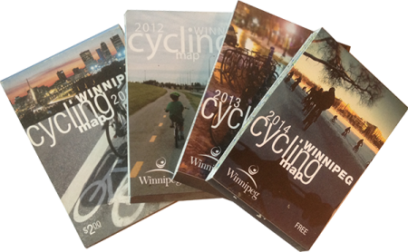
The City of Winnipeg’s cycling map is published annually and is developed through a partnership with Bike Winnipeg, Winnipeg Trails Association, Manitoba Cycling Association, Climate Change Connection, Green Action Centre, Physical Activity Coalition of Manitoba and Winnipeg in motion. They are available in public libraries, bicycle retailers, hotels and other tourist hotspots.
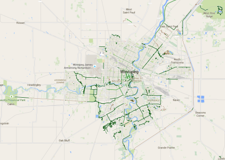
Google’s Map of Winnipeg – Turn the Bike Layer On!
Winnipeg Neighbourhood Walking and Cycling Maps
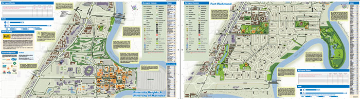
In 2013, Winnipeg Trails partnered with Green Action Centre‘s Active and Safe Routes to School program, dozens of local community groups and Neighbourhoods Alive! to help create the first small-scale neighbourhood walking and cycling map for the communities of Fort Richmond and University Heights. Check it out. There is even a Mandarin version.